Newark, NJ has been under serious redevelopment for the past few decades. We have seen Major companies move their headquarters to Newark and each ward undergo intense urban revitalization.
Newark has had a need for a long time to redevelop. The city has been trying to eliminate blighted condition, provide more affordable housing, clean up the streets and environment, and more recently attract private capital investments. Three major corporations have made Newark home to their headquarters. Prudential Financial, Panasonic Corporation Of North America, and Public Service Enterprise
The 18-story building on the Rutgers University-owned property was once used as a parking garage. It is being revitalized and redeveloped into residential units, institutional space, and retail space.
With all of this redevelopment we are starting to see some serious backlashes. New restaurant and top of the line apartments are raising serious concerns with those already living in Newark. The big boom of industry is increasing the racial and economic diversities at alarming rates. Redeveloping the city has been a difficult tax in the area of housing. Developers are running to Newark with a desire for profit. Affordable housing has been an issue and is a serious concern with high-end development projects replaces affordable housing options.
We are actively involved in implementing strategies to ensure that the investment boom benefits all Newark-ers, of all ages, races and ethnicities, in every neighborhood and that none of us are pushed out by the changes taking place”
The city is working with developers to find solutions for this problem with a new commission and incentives to developers to provide affordable housing. Newark is also taking steps toward fighting gentrification specifically by creating the Office of Affordable Housing. Other city programs are working on Inclusionary Zoning, foreclosure prevention programs, homestead ordinances, neighborhood development programs, stronger rent controls and more.
The micro-mobility future in America is finally here. According to the National Association of City Transportation Officials, in 2018, ridership for shared e-scooters across American cities has doubled, totaled in 38.5 million trips, and beating the number of trips made compared to city-sponsored bike share for the first time. City-sponsored bikes, on the other hand, such as Boston’s Blue Bikes or the Bay Area’s Ford GoBike, made a total of 36 million trips; however, NYC’s Citi Bikes accounted for almost half of docked bike share trips.
With these numbers expected to grow and deployed in more cities, there is an opposition against such scooters claiming to be unsafe and ugly in city streets and an intrusion from Big Tech. There have been numerous cases of residents destroying such scooters into rivers, setting them on fire, desecration, buried, or vandalizing the scooters to be completely inoperable.
As someone who
has used dockless transportation for several years and have also witnessed this
vandalism, I believe this mode of transport should be praised and beloved. The
transportation is exceptionally affordable, environmentally friendly, and
reduces congestion.
The current issues of public transit systems are the issue of the “Last Mile.” The “Last Mile” is a term describing the distance required to complete your commute where public transport cannot reach. For many commuters, this last mile can be off-putting and commonly achieved by driving. Companies such as Ofo or MoBike in China aimed to solve the “Last Mile” by offering the public, dockless bikes. These bikes designed with a lock unlockable through your smartphone. It is proving successful in providing millions that “Last Mile” solution while converting many to see bicycles as a better mode of transportation. Bird and Lime offer the same service but at a faster and more convenient rate through scooters instead of bikes. According to the NACTO, only 3 million trips were completed on dockless bikes in America, and the number is expected to decrease as Lime shift investment towards scooters and Ofo file for bankruptcy. Anything that removes the car from city streets is a net gain in cities.
Speaking from
personal experience, dockless modes of transport stopped me on multiple
occasions from using a car. I used to live in an industrial district an hour
away from the city of Shanghai. To travel to the city center, I would have to
take the subway, which is a 20-minute walk from my house. Because of dockless
scooters, I can travel to my station within 10 minutes or less. However, after
Ofo began filing for bankruptcy and the city government began stockpiling and
hiding scooters away from residents, my commute to the subway became ever more
difficult. Now I needed to ask my family if they could drive me from the subway
and back. If I were only to use public transportation to reach the subway, it
is still more expensive and timely than just using a bike. There is a bus that
reaches the subway; however, even the Chinese bus is more expensive than
dockless scooters.
The dockless
scooters provide fast and cheap transportation without ever relying on the car.
Such modes of transport should be praised and be encouraged to be used more
often. I do agree with many arguments against scooters, however, when weighed
between the benefits. Dockless modes of transportation are a vital aspect of
future mobility in urban spaces.
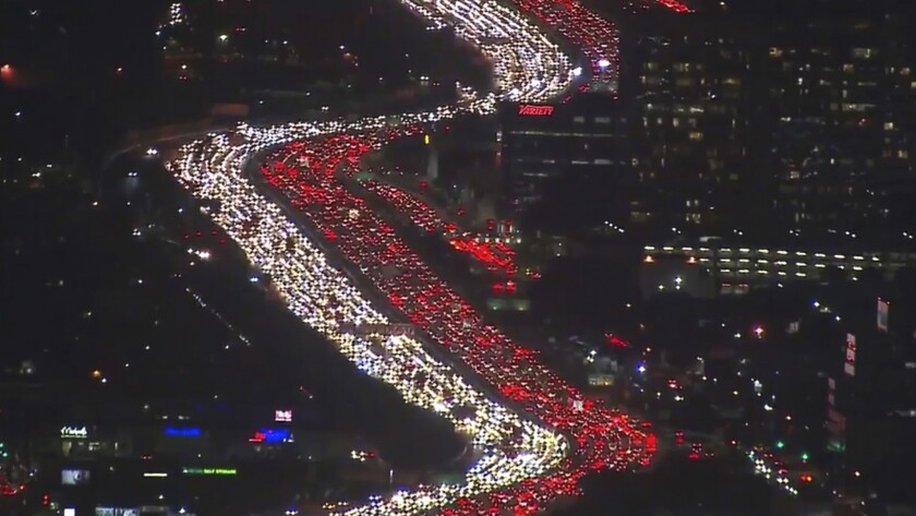
What is the first thing you think of when you hear Los Angeles and transportation? For many people, it’s cars and traffic. Los Angeles, California is notorious for its pollution and traffic issues, especially during rush hour. However, coming changes to the city may alter this negative association.
In 2017, the City of Los Angeles, led by Mayor Eric Garcetti, announced the “Twenty-Eight by ’28” initiative, which directs the Los Angeles County Metropolitan Transportation Authority (LA Metro) to aim for the completion of twenty-eight transportation projects in time for use by the 2028 Olympic Games in Los Angeles. These plans include improving the quality and quantity of Los Angeles County’s bike, pedestrian, motor vehicle, and public transportation infrastructure through greater safety, accessibility, availability, efficiency, and functionality. Mayor Garcetti believes the initiative will make a “more livable, successful and equitable region”.
Many of the projects originate from the LA Metro’s 2009 fifty-year plan and were already scheduled for completion before 2028. Using an estimated $26.2 billion, the agency hopes to accelerate the eight plans that are set to finish after the Olympics, but they are not obligated to do so.
Measure M and Measure R are publicly approved, active half-cent sales tax increases that fund a majority of the initiative. The former is permanent, while the latter runs from 2009-2039. However, some of the projects lack capital, so the agency is considering obtaining it through congestion and vehicle miles traveled pricing, fare increases, federal grants, public-private partnerships, sponsorships, and advertising.
I’m impressed by the Metro Board’s ability to get the Los Angeles County residents to support more taxes in the county. The way they went about obtaining funding for public projects is the best way possible. As discussed in class, any reliance on the federal government for capital is risky given the increasingly limited amount available. Additionally, charging unwilling people to fund public projects leads to unhappiness and distrust with the government. It is a positive sign that the public see the importance of improving the public transportation infrastructure to an extent where they are willing to pay for it. When people approve of government decisions, there is a greater ability to accomplish goals. Hopefully, other cities and towns can model their financing methods for projects off of how Los Angeles County went about it.
While private contractors have initiated many of the plans, they have faced a multitude of delays related to budget and site issues as well as workforce and material availability. Thus, many of the projects, such as the Crenshaw/LAX light rail line and MicroTransit, will not be fully operating in time meet the “Twenty-Eight by ’28” schedule. This may create a negative impact where LA Metro does anything necessary to speed up their plans’ timelines. For example, overspending or not taking the time to ensure they are making the best decisions and highest quality products.
“Twenty-Eight by ’28″‘s plan to expand roadways throughout Los Angeles is also concerning given the already car-centric nature of the city. Creating wider roads will continue to encourage residents and visitors alike to use cars to get around; in other words, it will lead to induced demand. Of course, there is no way to rid the city of excessive cars anytime soon without major issues, but putting more public funds towards establishing greater capacity and flow of automotive traffic will make it even harder for that ever to occur. Public transportation ridership has been decreasing over the years and that will continue if it gets easier to use cars in Los Angeles. Therefore, policies that make the public grumble, such as congestion and vehicle miles travelled pricing, are crucial to deterring personal automobile dependence in the city and supporting stronger public transportation methods.
Aside from roadway “enhancements”, Los Angeles’s “Twenty-Eight by ‘28” is a positive step to making Los Angeles a more sustainable, efficient, healthy, and happier place. Furthermore, the Olympic Games help to give both the public and the government an incentive to create and show off the best version of Los Angeles possible, which includes much stronger mobility options. More importantly, however, it will benefit tourists and residents before and after the Olympic Games to have a greater ability to travel throughout the entire region safer and faster. Los Angeles needs to be ready to adapt to current and future environment changes, which includes a decrease in oil and a weakening of the auto industry. Hopefully, the projects completed under “Twenty-Eight by ’28” become the foundation for a more connected Los Angeles where there are mobility options better than a personal vehicle.
On an evening in March of this year, I decided to have a bite to eat on Easton Avenue, and left the College Avenue student center in that direction. I passed by multiple residential single and multi-family housing, with inadequate street lighting. It was slightly unnerving, and I walked with a bit of pace and a bit more awareness of my surroundings. This wasn’t necessarily a “bad neighborhood”, but better safe than sorry. I passed a driveway of a home and was startled as a figure stepped at me from the dark alleyway. I reacted in surprise, as did the figure. Turns out, it was just the homeowner of the property, taking out the trash. We both apologized for startling each other and I walked to Easton Avenue without much further incident.
Since then, I’ve been much more weary of these “conflict points”, as I will call them. Now that I have a greater awareness of it, I’ve come to realize how common these points are, at varying magnitudes. Conflict points are generally driveways and alleyways that have a few notable features.
Inadequate lighting
Poor exposure to the street
Streets with low traffic
Areas frequented by children or other vulnerable people.
Spaces that can be quickly ambushed or retreated from.
Spaces in areas that are considered unsafe from a law enforcement perspective.
Why are conflict points dangerous? The limited visibility and exposure acts as a hiding place and safe space of undesirable activity. Engaging in these spaces is risky, as you never know who is hiding in the dark. Conflict points are also effective ambush points for criminals to get a jump on their victim and pull them into an alley to get mugged, abducted, or sexually assaulted. Such as the case of a child getting kidnapped on a driveway and then taken to an alleyway to be assaulted.
Usually conflict points will usually be in dense urban places. In this example, I take a look at a single block in New Brunswick near where my incident occurred, and marked locations that I deemed to be dangerous conflict points. This area is particularly interesting, as the Lincoln Elementary School is located on the block, and small children commute here nearly every day.
The red X’s mark conflict points, and one can see there is a fair few on this single block. Looking at other blocks, you can deduce other conflict points just from satellite imagery.
As planners, we should seek out and mediate these conditions that threaten public safety and hurt a cities images or facilitate crime. I believe that we need to encourage a “One way-in, one way-out” kind of street style. The term that I came up with myself, describes a system where there are limited gaps or spaces between buildings, by encouraging a philosophy that there is no way or reason to go anywhere other than straight ahead, unless your destination is on that particular street. Basically, if you’re passing through, there should be limited, if at all, spaces or gaps to turn right or left off the street.
This can be done in a few ways. The most first would be to encourage single-family attached housing development, to completely eliminate the gaps between homes. This however does nothing for previous communities plagued by this issue, unless one is to completely tear down and redevelop a community in this way. I would perhaps be more realistic to have something that links two homes together, that protects those on the street and thwarts people from entering.
A fence would fit well in this scenario, however since in most cases this gap is there as a means of access into a person’s yard, it would have to be some sort of gate. This will still be appropriate, as a gate that is tall and inconvenient to get around will be a natural barrier from people to engage in undesirable activity, and anyone that ambushes someone will have to go through the process of opening the gate or trying to climb over it, giving the victim valuable time to run or scream for help.
Two sets of buildings on Stone Street. The gap on the left has very little exposure and one can easily get ambushes or be engaged by stranger perhaps wishing to cause harm. The gap on the right has similar dimensions, but the fence/gate of the building naturally thwarts engagement by providing a physical barrier to the street, and also gives a sense of enclosure to the street.
Other recommendations include better lighting and reducing buildings and objects that impair exposure and visibility. Alleyways are perhaps the biggest inhibitor of unrest when navigating a city. Think of when alleyways are depicted in media, filled with rats, trash, stray cats, and undesirable and criminal activity; Batman’s parents are often depicted in media as being murdered in an alleyway. It is important to take these spaces seriously from a public safety point of view, as their inhabitants threaten the residents of the city. Had I been encountered in a less-safe area by an individual out to do harm, I might not be here to tell this story.
The concept of induced demand is one of the most frequently discussed concepts in transportation planning by urban planners. The idea that it’s impossible to build one’s way out of traffic congestion, due to new road supply creating its own demand, naturally appeals to people advocating investment in other modes of transit. However, while it’s true that urban congestion remains stubbornly persistent in the United States year after year, planners must be careful not to construe this as affirming induced demand in all cases of congestion. Potential contradictory examples stress that the difference between induced and latent demand is not academic, and there are real risks for planners should they conflate the two or oversimplify the underlying phenomena.
An important consideration that can get overlooked in a simplified view of induced demand is that roads are not demanded for their own sake, but in order to reach desired destinations. Sources like the Congress for the New Urbanism’s Freeways Without Futures report frequently mention excessive capacities on highways serving cities such as Buffalo or Detroit, often built before those cities entered long periods of decline and disinvestment which frustrated their intended purpose. That highways can remain empty in such areas, however, suggests that exogenous factors play a major role in shaping demand for roadways, not the supply of roads itself, as some theories of induced demand would suggest.
Because the supply of roads has only a marginal effect on their own demand, it’s more likely that most examples of induced demand are actually examples of latent demand. Absent any tolls, traffic congestion is the main pricing mechanism for most commuters’ decision to drive, causing some commuters to avoid a highway if its existing capacity wouldn’t allow them to make their trips within their tolerances for congestion. Expanding a highway pushes the supply curve for those trips to the right, bringing more potential car trips into a range of commute times that drivers are willing to tolerate, which then stabilizes at a new equilibrium as the number of cars on the road increases up to this new capacity for them.
Readers might wonder why distinguishing between latent demand and induced demand matters, if the former fills new highways just as the latter is theorized to. The distinction is not merely academic, because while induced demand suggests highway expansion is futile due to supply creating its own demand, latent demand suggests it’s theoretically possible, if also impractical, to build enough capacity to satisfy all demand in the short run. This changes which arguments against highway expansion are most persuasive; planners should demonstrate how building out highways to satisfy all latent demand would have enormous marginal costs while reaping diminishing marginal utility. Put another way, traffic engineers could end Los Angeles’s traffic problem by spending many billions of dollars demolishing the city for thousands of new freeway lanes; there just wouldn’t be a city left to visit afterwards.
Should urban planners fail to distinguish the sources of congestion and attribute too much of it to induced demand, there’s a real risk of transit improvement projects failing to persuade the public. Many aspiring urban planners are dissatisfied with the status quo in transit and entered the field specifically to exact change, but this desire for change doesn’t justify oversimplifying how traffic congestion works just because it affirms their biases. Removing highways and reducing street lanes for cars may seem the obvious choice for aspiring planners, but the extent to which good ideas calcify into a rigid, dogmatic design style is the extent to which obstacles to clear thinking prevent urban planners and designers from solving real design problems.
Many people interested in urban planning see the reduction and elimination of suburban sprawl as a top priority for the profession. The complexities of the social and economic forces that drive sprawl, however, may be beyond the profession’s power to solve alone.
Readers would be very hard-pressed to find an urban planner who loves suburban sprawl. Derided for its high environmental impact, contributions to physical and mental health issues, and history of discriminatory housing practices, suburbia quickly becomes a word recoiled from by those learning about how cities are made. Many planning students, the author included, can trace their decision to study urban planning and design back to a personal aversion for suburban sprawl, and a desire to do their part in eradicate this development pattern from society. Such students might wish they had picked another major, however, as there are strong reasons to believe that a real solution to suburban sprawl cannot come from urban planners alone.
The first challenge to the urban planner’s crusade against sprawl is the often fierce political resistance to redevelop existing towns and cities to a higher density in order to combat it. While Dr. Reid Ewing makes a strong argument that suburban sprawl is equally a matter of poor design as it is low density, the fact remains that limitations on building upwards, relative to building outwards, incentivize new development to continue its sprawling ways. Planners don’t simply wave their magic wands and rezone a subdivision into a walkable town center, however; suburban homeowners may not get a direct vote on rezoning, but they do get to vote for people who can influence zoning decisions. Especially in wealthier suburbs, where political resistance in defense of privileges is organized and influential, opposition to the planner’s anti-sprawl agenda has little problem swaying town hall in its favor, leaving planners wondering if they should have majored in political science instead.
Photograph from a protest against new development in suburban Australia. Not only does much new redevelopment and infill of existing suburbs attract opposition, it also deters developers, who would rather not run such a gauntlet compared to less risky greenfield development.
Should planners succeed in rezoning a target growth area to combat sprawl, their next major obstacle comes from needing to get developers on board. Whether planners and public policymakers like it or not, development patterns are driven primarily by economics, and no developer, no matter how altruistic, readily signs off on a money-losing venture. Home builders are highly sensitive to building costs, and with organizations like the National Association of Home Builders citing especially high regulatory burdens in the multi-family segment, there’s that much less financial incentive to go along with planners’ visions for denser, mixed-use development. It’s almost enough to make planning students consider changing major to economics, given the limits of their field on this front.
But even if planners can bring all their powers to bear to stop to suburban sprawl, they run the risk of contradicting their other goals by making housing less affordable. It may be within a planner’s power to implement greenbelts, limit permits for new residential construction, and require developers to provide for their own infrastructure costs, but while these measures may eliminate sprawl, they also limit housing supply and increase the costs of building, resulting in housing becoming less affordable. Attempts to remedy this with mandates for affordable housing often fall short, as developers, for reasons mentioned earlier, have strong interests in finding ways to get around such commitments in order to not lose money. In a way, it seems that planners are their own worst enemies in fight for affordable housing, inasmuch as their sensibilities against sprawl contribute to the problem.
City Council meeting in Pasadena. Tackling future development issues will require greater communication between experts of different fields, rather than relying sorely on urban planners to solve the problem.
Suburban sprawl represents many social and economic problems that are worth addressing, but those problems won’t be solved by urban planners alone. The ability of planners to effect real change on development patterns is more limited than many would like to admit, especially in the face of their often quite organized and influential opposition. Furthermore, even an urban planner gets everything he or she could want in anti-sprawl measures, this is often at cost of other worthy planning objectives, such as housing affordability. It’s up to today’s planners to recognize their field’s limitations in tackling multi-faceted social phenomenon beyond their own power to solve, and work together with professionals in other public policy and economic fields to coordinate their efforts towards a coherent, equitable vision of future towns and cities.
HQ2, Amazon’s second headquarters and a name that will live in infamy, at least after the lengthy and grueling process that cities across America went through only to find out that their city was not ‘the one’. Announced in September of 2017, Amazons HQ2 was to be the companies second ‘home base’ offering near 50,000 jobs and raising upwards of tens of billions of dollars in and around the city it was based in. Just from that statement alone, one can see why any city would be willing to jump through a few hoops to host Amazon’s future HQ2. After all, Amazon’s original headquarters located in Seattle, Washington has proved to be a boon to the city providing substantial economic benefits. Amazon estimates that since 2010 it has raised over $38 billion in investments for the city and quotes that, “every dollar invested by Amazon in Seattle generated an additional $1.40 for the city’s economy overall.” (Amazon.com). Additional benefits can be seen in Table 1 below.
Table 1: Benefits that HQ1 has provided to Seattle between 2010-2016
The responses from local governments following the announcement of HQ2 blew up all across the continent. Bids amounted in the hundreds, 238 to be exact, and ranged from smaller metropolitan areas such as San Jose, California, to areas as large as the state of Idaho, which submitted a statewide bid (Qz.com). Communities promoted themselves using methods such as sales and promotion, and subsidization. Cities advertised their potential claiming they would welcome Amazon with open arms and that Amazon would benefit from the array of assets the city possessed. Cites also used subsidization to promote themselves. Subsidies ranged in variety, from $800 million in incentive packages from Arlington, VA to a 99-year lease deal amounting to near $8 billion in tax incentives by DFW Airport in Dallas, TX and everything in between. Clearly, Amazon was faced with a daunting challenge. Or was it? After narrowing down the search, 20 finalists were considered including cities such as Atlanta Georgia, Boston Massachusetts, and Toronto, Canada. Each finalist received a message from Amazon executive Holly Sullivan saying something along the lines of, “we would like to move (insert city) forward in the process so we can continue to learn more about your community, your talent, and potential real estate options. Please email me back with available times for a call so we can discuss next steps.”. Like a high school senior waiting to hear back from a potential college, finalists were delighted when the email finally came around. For some cities, HQ2 would be the stimulation local economies needed such as Newark, New Jersey which has struggled financially for decades. For other cities such as New York and Boston, HQ2 would cement their spot as centers for the tech industry. So it would be safe to say, for these cities, a lot was on the line.
The final 20 cities that made Amazon’s short list for HQ2 (trending toward the Northeastern United States)
After considering its options, Amazon decided to split its new headquarters between Arlington, Virginia and New York City. Referring back to my comment earlier about Amazon’s ‘difficult’ decision, many, including myself, are skeptical about how ‘difficult’ this decision actually was. Reasons for this vary but many point out the lack of transparency in Amazon’s decision making, referred to as information asymmetry by Contemporary Urban Planning. Information asymmetry is at play because Amazon is being offered subsidies by cities. These cities may have an idea of how much they should offer to entice Amazon but many don’t have a specific bottom line. On the other hand for Amazon, the greater the subsidy the better the outcome. The issue then arises since cities have to remain relatively transparent while companies can withhold information about how much they want. This typically results in a lose lose situation for the city and a win win for the company. In addition to this, some studies, such as the one conducted by The Upjohn Institute, have found that only 2-25% of firms are influenced by tax incentives. With this knowledge, one could conclude that Amazon had already made its decision even before it was given options and that any indecision that it displayed was to only ring out any additional subsidies a city would provide. We might never know, but one thing is prevailing and that is Amazon certainly came out as the winner.
In recent history, Princeton Township and Princeton
Borough merged together to create one unified Princeton. The now-defunct Princeton
Borough well-known for being a great small city, home to Princeton University
and an amazing, walkable downtown. On the other end is Princeton Township,
close to Route 1 and West Windsor. There, it is a complete, stark contrast from
Princeton Township, surrounding the former Borough. The area especially surrounding
Route 1 is riddled with urban sprawl, is littered with lower-density office and
commercial, and is not walkable or traversable by public transit in the least
bit.
Part of Route 1 Southbound in Edison, NJ (Source: Google Streetview)
Route 1 is one of 4 southbound roads spanning Middlesex
and Mercer County; the other three being Interstate 95, US Route 130, and State
Route 27. Route 27 is mostly a smaller, county level road with mostly medium
density commercial buildings. I-95 is a major freeway, while Route 130 goes
through mostly rural areas, although it suffers from some sprawl in some parts
of East Windsor, being the main road. However, Route 1 suffers from a major
identity crisis, especially with the amount of people that use the road to
commute to and from work.
Route 1, towards the beginning in Trenton, is a
standard, 4-lane divided highway. However, starting in Lawrenceville, there are
significant amounts of sprawl that pops up, including significant amounts of
car dealerships, big-box stores, large office complexes, and hotels that line
both sides of the highway. The trend continues northbound, with similar
patterns happening in Princeton Junction and Edison especially.
The main issue is with Route 1 is that it tries to be way too much of what it can be. It is home to some of the main office and commercial districts of multiple townships and cities, while also being one of the main non-toll roads going south to north. Despite being mostly a six and even eight-lane highway in some parts, traffic ends up being horrible during rush hour. Part of this reason stems from the fact that not only are people commuting south from New York, you have the several offices and commercial spaces that need to utilize the road that is closest to them, causing more people to go on the road than what it was planned for. To add insult to injury, the road has stop lights in multiple areas near Princeton and Edison, so that makes matters for traffic worse. (GIS Data Here)
Traffic Data of Route 1 (Centered) (Data via ArcGIS)
Now, how do we suppose to fix it long-term? First, the
road needs an identity established; it needs to have its future determined
either as a highway or as a main business district for towns. If the
development route is chosen, then towns, counties, and the state would have to make
sure that they would have to allocate traffic to the different local roads,
which may prove to be impractical. The more practical route would be to center
development in other areas, and essentially plan the sprawl out of Route 1. Some
of the office complexes would be harder to move, but a lot of the commercial
space would be more able to relocate to other locations, in a perfect world.
Climate Scientist have been stating for quite some time that global warming is becoming a serious issue in the world. Although, there are still skeptics who don’t believe it is a problem or simply don’t care. This controversial topic is truly the strangest issue I’ve ever encountered in the political and economical world. How do you get the majority of the country to care about the future? Considering that life is so short that they wont see many of the benefits that the environmental and energy plans intend to accomplish in their lifetime. That is a question for another day.
As for now, I’m going to discuss some of the energy plans that New York Senator Chuck Schumer has for the future of the country if “the democrats regain control of the Senate in 2020”. This blog entry is based off the news article entitled “Chuck Schumer: A Bold Plan for Clean Cars” by Chuck Schumer. Mr. Schumer plans to
“unite the American environmental movement, the American labor movement and large automakers,”
by making it financially possible for Americans to purchase electric cars. In fact, he actually wants to completely replace all gas powered cars over to the new electric energy medium by 2040. Which is in my opinion an obtainable goal if the country is willing to supply federal funding toward his “clean car plan”. I wonder what kind of affect a plan like this will have economically for people.
Some ideas that Senator Schumer has planned for his “clean car plan” are allowing discounted prices on new electric cars when you trade in a gas powered vehicle. Another aspect of the plan includes constructing numerous electric charging stations which are federally funded all over the country. Lastly, he stated that he wanted to establish the U.S. as a top manufacturer of batteries and electric cars. This would add exceptional growth to our GDP thus creating larger quantities of jobs.
Some statistics that I find particularly interesting are that about twenty five percent of the carbon dioxide released in to the atmosphere from our nation is caused by transportation. Also, the amount of carbon dioxide in the atmosphere has raised approximately seventy parts per million in the last fifty years. The U.S. is the second greatest contributor to carbon dioxide in the atmosphere with China being the first.
To conclude, energy plans for the future of the country are often apposed by a surprisingly large majority. This could be because the people who have these opinions feel that the politicians are lacking in other areas of their expertise. I hope we can find a politician in the near future who can accommodate and balance the current and future needs of our great nation.
After reading the article entitled “Crafting the Next Generation of Smart Growth Policies” by Gregory K. Ingram, the president of The Lincoln Institute of Land Policy, I feel that smart growth is a planning style that needs to be incorporated into all master plans in the U.S.. It is simply put, a growing concern of mine that our planning procedures are not sustainable because we are not planning for the future. The growing population is resulting in an increasing amount of suburban sprawl which is developing on land that needs to be preserved for various environmental reasons. We need to preserve wetlands, protect undeveloped land, and plan for alternative energy.
According to the Mr. Ingram’s report, many states such as Florida, Maryland, New Jersey, and Oregon have implemented smart growth into their state legislation. This is rather positive information that proves progress in the smart growth planning strategy can be accomplished if undertaken in the political arena. The findings for the individual states successes in undertaking such initiatives was “flakey” because there objectives which are,
“promoting compact human settlement, protecting undeveloped land, providing a variety of transportation options, maintaining affordable housing, and achieving positive fiscal impacts,”
where not fully achieved in each state. Unfortunately, some states achieved some of what they set out to achieve, but none achieved 100% of their smart growth planning goals. The good news is there was some success, for instance, Maryland succeeded in conserving farm land through easements which basically saved land from being developed thereby protecting natural resources in the state. New Jersey responded to ‘maintaining affordable housing” by implementing policies enacted by the Supreme Court which increased cheap housing for many residents. Unfortunately, one result of the construction of affordable housing in suburban environments is the destruction of natural undeveloped land that could have been utilized for more environmental practices such as land conservation. Finding a balance between housing construction and land conservation is extremely hard in New Jersey because of the overcrowding of the state.
Other findings that I found interesting in this article stated that Florida failed in “promoting compact human settlements,” which I find to be no surprise. Florida is the third most populated state in the U.S. and much of the land development is constructed on land that should be conserved. Unfortunately, the political climate of the state doesn’t reflect what is best for the environment there. They are developing in regions of the state like the everglades which need to be state parks in order to preserve what natural environment we have left. To conclude, smart growth is a important aspect of planning which will eventually reach every master plan in the country.


/cdn.vox-cdn.com/uploads/chorus_image/image/59732685/MW_GB969_amazon_20180118094051_ZH.0.jpg)


